Kwisa begins in the Izera Mountains, where, at an altitude of 940-1090 m, three spring streams, Widły I, II, III, flow out. The river is 140,360 km long and ends in Bóbr before Żagań. Kwisa is not very difficult to swim, the waterway is very picturesque and diverse. You can feel real relaxation while sailing the route from Kliczków through Bory Dolnośląskie. The current in the river is swift, the water is clean and full of fish. Beavers also live here, which can be seen from the large number of trees lowered into the river, you can also meet playfully frolicking otters. The river is largely unregulated, so often along the rafting route, we can come across fallen tree trunks and high slopes of the banks, revealing the geological cross-section of the earth. The shores are covered with trees, among them the eye-catching is mainly oaks of impressive size. The pristine appearance of the Kwisa River Valley provides us with a unique experience and makes us want to come back here.
Route I
Nowa Wieś - Osieczów
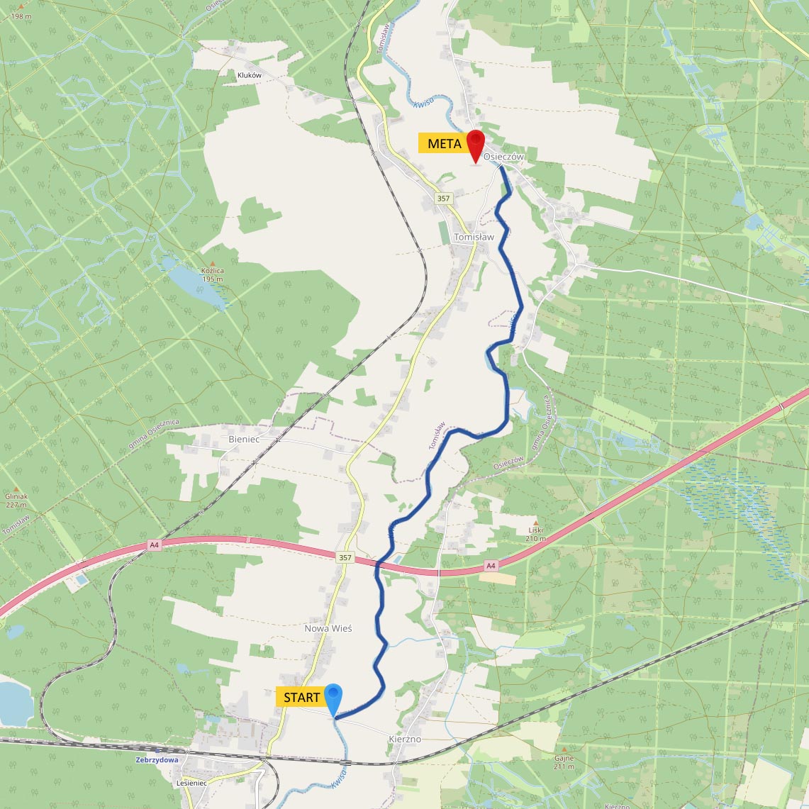 difficulty of the route: easy
duration: 3 hours
section length: 8,450 km
The route begins at the road bridge on the Nowa Wieś-Kierżno road. After a few minutes of rafting, we come across a 1.20 m high water threshold. It is located under a wooden footbridge, which is in a very bad technical condition (walking on it is not recommended). Then we sail among fields and meadows located on both banks of the river, lush with shrubs. In the center of Tomisław we flow under a wooden footbridge hanging on ropes, connecting the villages of Tomisław and Osieczów. The trip ends in front of the road bridge in Osieczów. The route is picturesque and easy to navigate.
Route II
Tomisław - Osiecznica
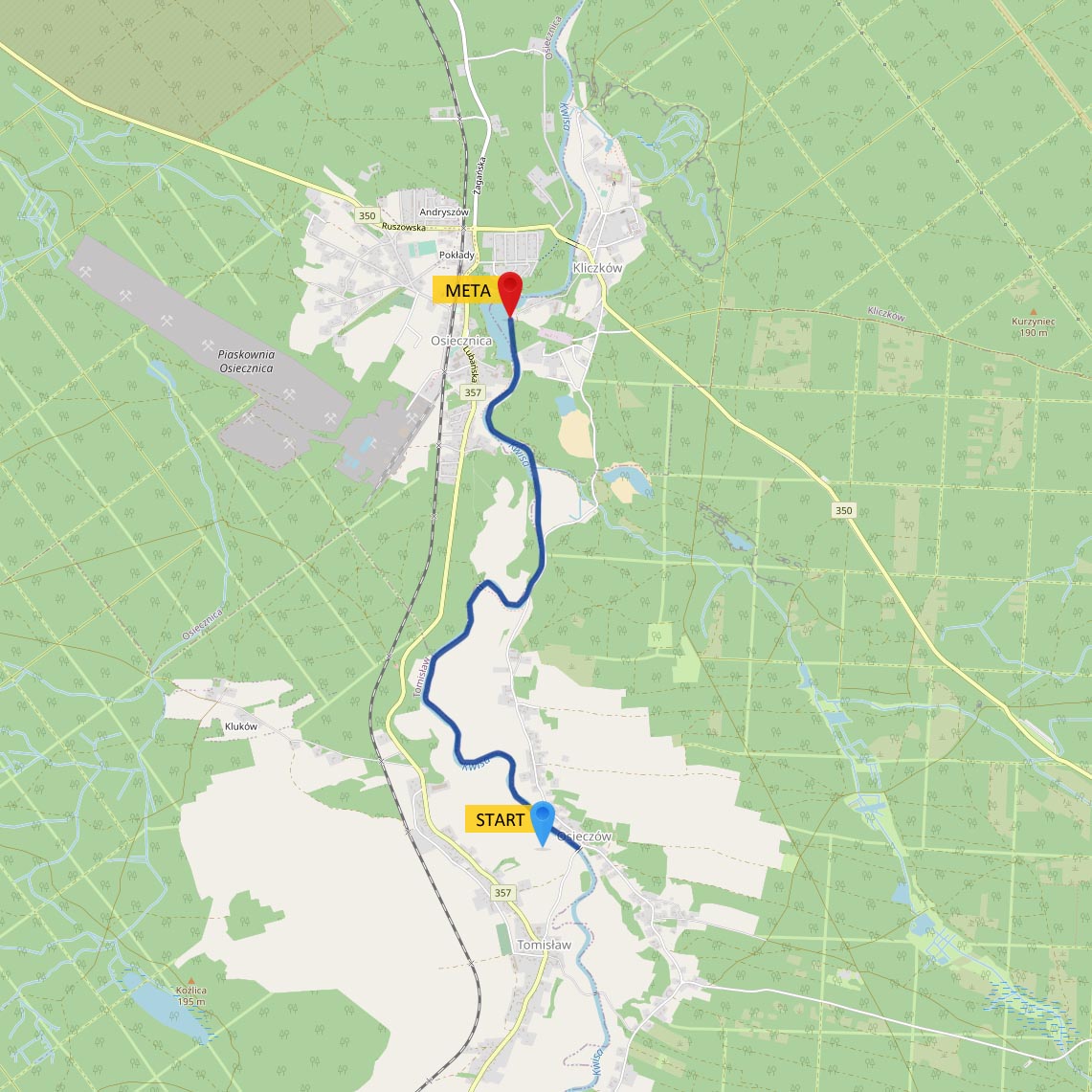 difficulty of the route: difficult
duration: 2,5 hours
section length: 5,850 km
We start at the road bridge on the Tomisław-Osieczów road. After swimming about 100 m, we come across a 1 m high regulatory threshold, we flow through the middle in the breach in the threshold. We continue our journey calmly, among the meadows and fields by the river. In front of Osiecznica there are two very high steps, 2.20 m high. The steps can be climbed only by experienced people, for less experienced people it is advisable to carry pontoons. In the village of Osiecznica we come across the so-called Damn Dam. At a length of 60 m, we have a large water fall, the current is fast, and large stones stick out of the water, so if you are not experienced in negotiating more difficult sections of the river, we suggest moving or dragging the pontoons. After Diablą Dama, we try to avoid the protruding boulders from the water, and then we go out into the calm water of the lagoon at the weir and the hydroelectric power plant in Kliczków. At this point, the trip ends on the left. The route is very difficult due to the high thresholds and Devil's Dam.
Route III
Kliczków - Przejęsław
 difficulty of the route: easy
duration: 1 hour
section length: 3,450 km
We start the trip at the entrance gate to the premises of the Kliczków Castle. After 300 meters, we pass a newly built hydroelectric power plant. We continue our journey through forest areas. The shores here are heavily overgrown with shrubs, we can also observe single oaks of impressive size. The trip ends at the road bridge in Przejęsław. It is possible to extend the trip by 1,300 m, then we end before the weir and the hydroelectric power plant in Przejęsław. The route is very easy to travel, recommended for beginners.
Route IV
Kliczków - Ławszowa
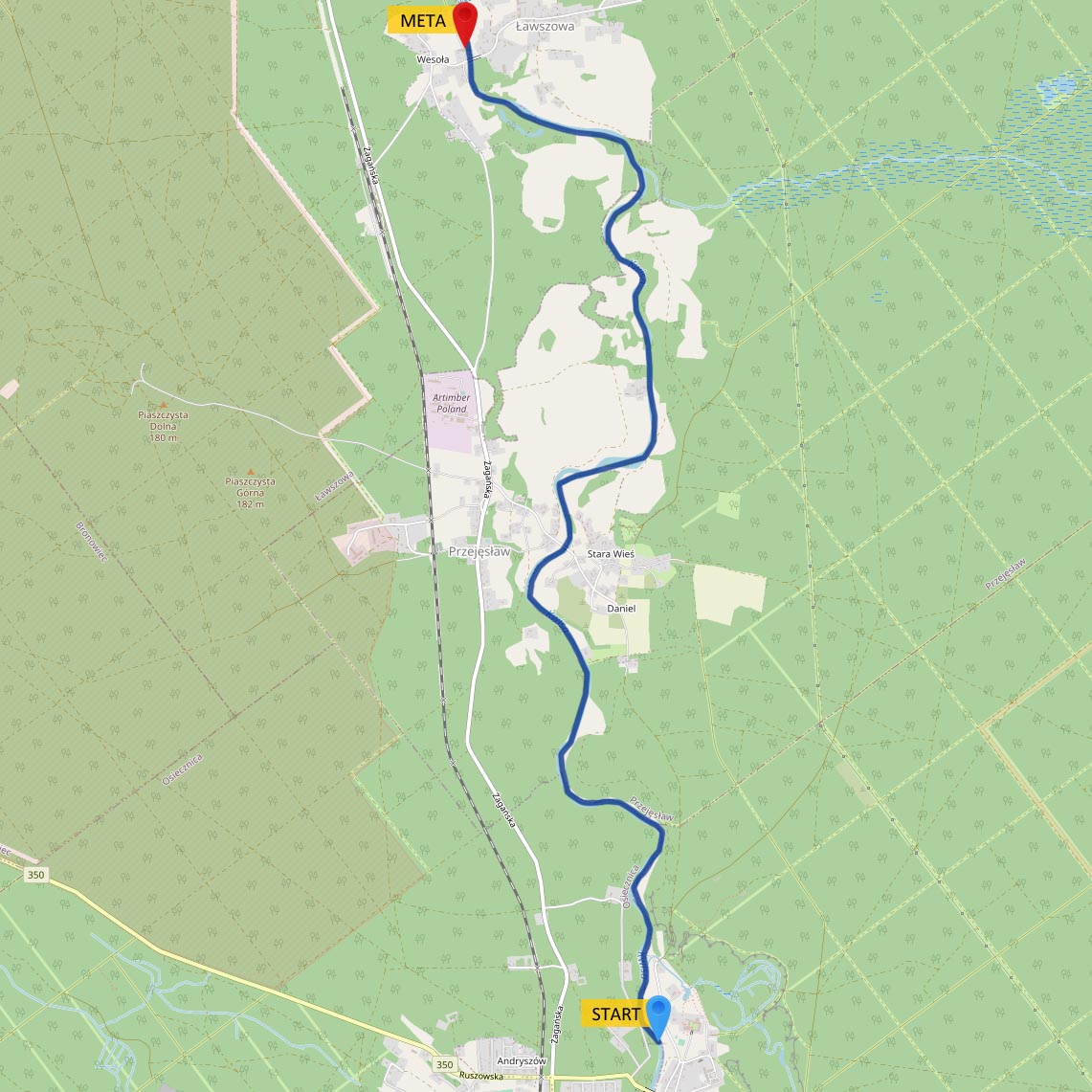 difficulty of the route: easy
duration: 3 hours
section length: 8,040 km
We start the trip at the entrance gate to the Kliczków Castle. After 300 m, we pass a newly built hydroelectric power plant. We continue our journey through forest areas. The shores here are heavily overgrown with shrubs, we can observe single oaks of impressive size. Then we pass the town of Przejęsław, reach a weir and a hydroelectric power plant, here we carry the pontoons on the right side for about 50 m. Directly behind the power plant we flow through the former water threshold, the water here is much faster. Further, the river meanders through the forest and among fields and meadows located in the middle of the forest. We reach the damaged old weir in Ławszowa and cross it from the left. We finish the trip at the road bridge in Ławszowa. The route is very picturesque and varied, we recommend canoeing trips for schools, integration trips for companies and organized groups.
Route V
Ławszowa - Luboszów
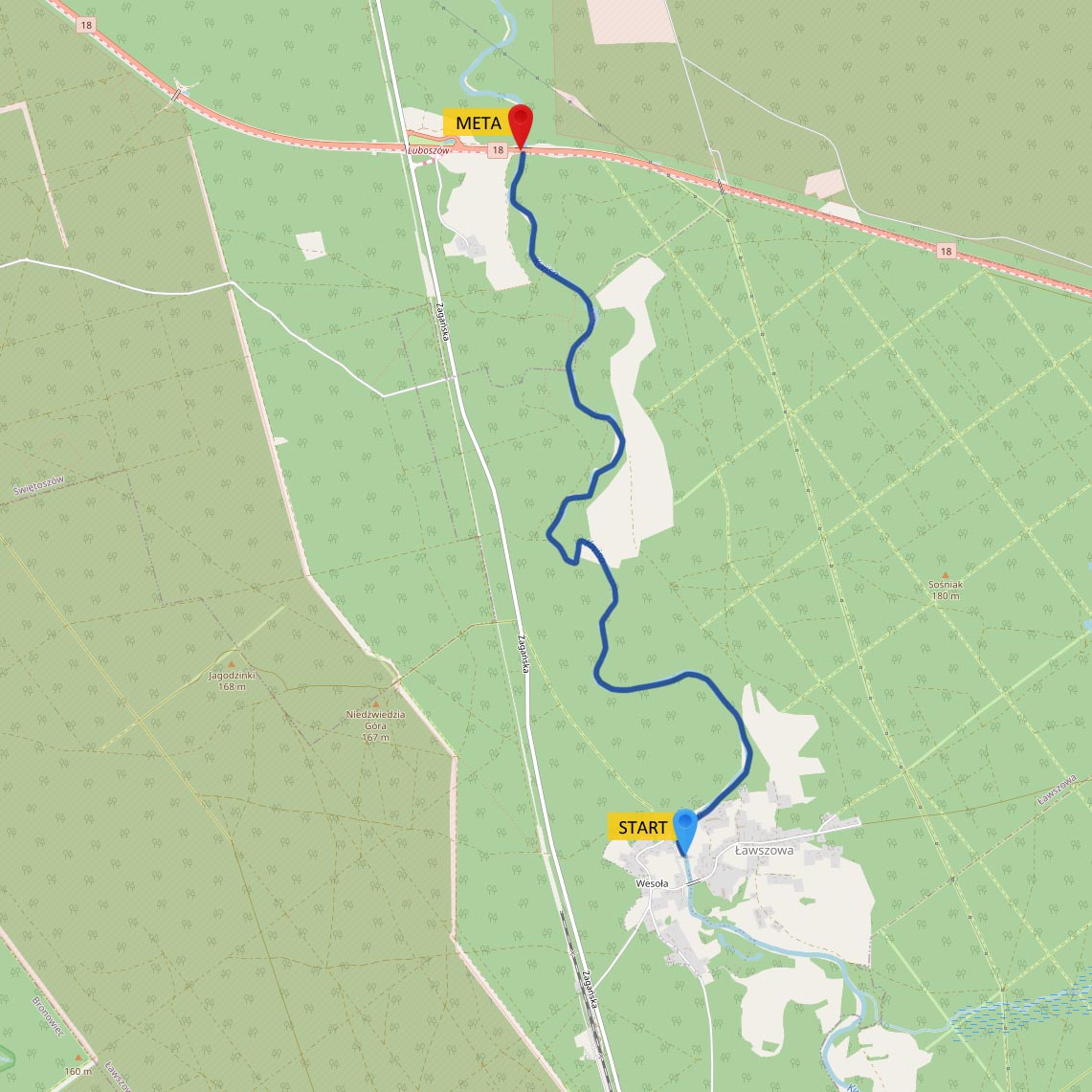 difficulty of the route: easy
duration: 2,5 hours
section length: 6,030 km
We start the trip at the road bridge in Ławszowa. In a short time, we pass the last buildings of the village and continue only through the forest in the Lower Silesian Forests. We pass high slopes of the banks, revealing the geological cross-section of the earth, and wild sandy beaches located in the middle of the forest. With a bit of luck, we can come across wild animals such as: deer, roe deer, wild boar or fox. In many places, we avoid trees that have been released into the water by beavers. With such a picturesque scenery, we reach the regulatory stage in Luboszów, 0.80 m high (it is interesting that Luboszów is the smallest town in Poland, inhabited by only two people). We flow the step in the middle. The trip ends at the road bridge on the Wrocław-Olszyna highway, Berlin. A very picturesque route, meandering through Bory Dolnośląskie. Recommended for trips for school children, integration for companies and for organized groups.
Route VI
Luboszów - Świętoszów
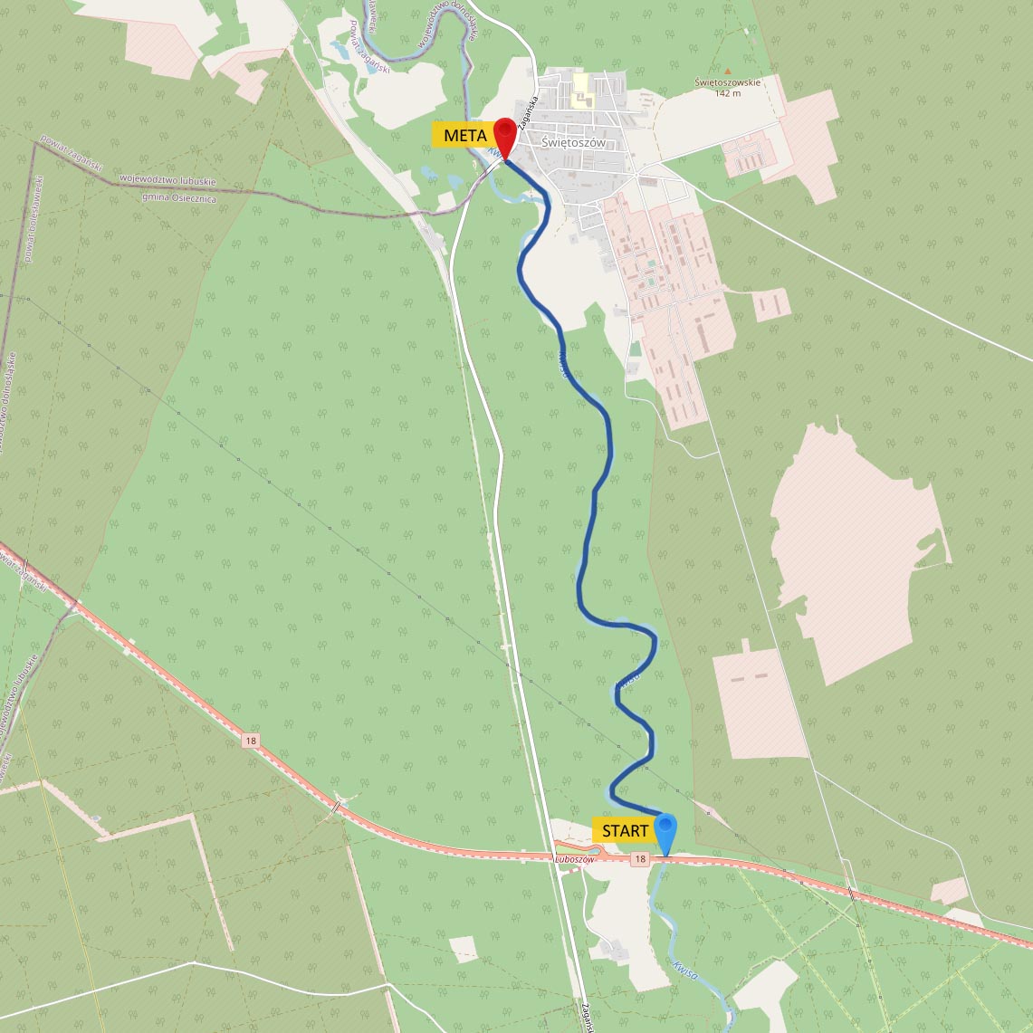 difficulty of the route: medium
duration: 3 hours
section length: 6,120 km
We start the trip at the road bridge on the Wrocław-Olszyna highway, Berlin. The route winds through the forest in Bory Dolnośląskie. No water thresholds, yet we come across a significant number of obstacles from tree trunks dropped into the water, blocking the free flow of pontoons. The forests along the river abound with wildlife that has found its peace here away from civilization. You can see the ruins of the military bridge used by the soldiers of the Soviet Army, who were staying here on the training ground. Before Świętoszów, we pass the water weir on the left and continue along the water canal leading to the power plant. Before the power plant, we finish the trip at the road bridge in Świętoszów.
Route VII
Ławszowa - Świętoszów
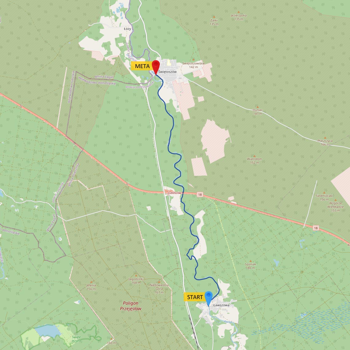 difficulty of the route: medium
duration: 5,5 hours
section length: 12,600 km
We start the trip at the road bridge in Ławszowa. The route leads through the forest in Bory Dolnośląskie. It is a very long canoeing trip that allows us to commune with wildlife for half of the day. This section was created for the persistent ones, from the combination of routes V and VI. We cross the water sill in Luboszów and swim under the road bridge (Wrocław-Olszyna highway, Berlin). After dealing with fallen tree trunks in the river, we pass the ruins of the bridge used by the soldiers of the Soviet Army during their stay in Świętoszów. The trip ends at the road bridge in Świętoszów.
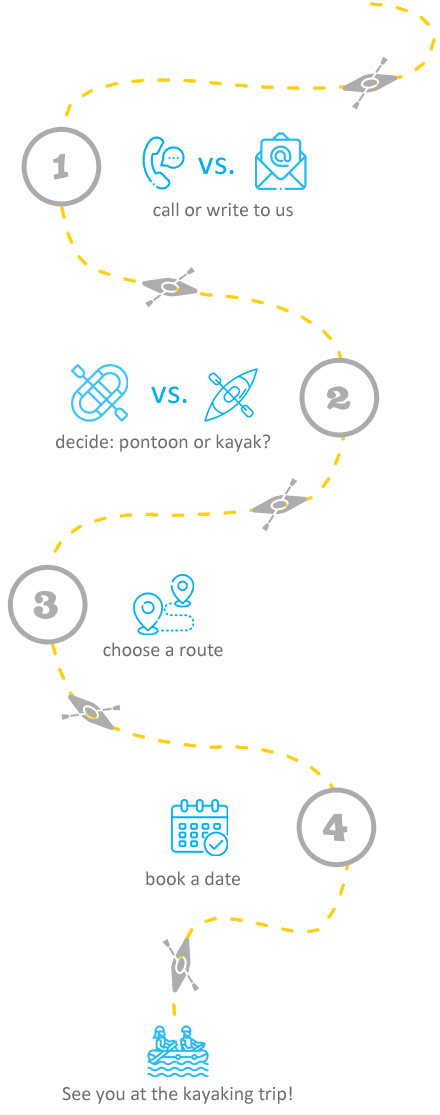
The duration of the trip is approximate and depends on many factors (weather, number of participants and their skills). The organizer of the kayaking trip reserves its cancellation due to the current weather and conditions on the river!